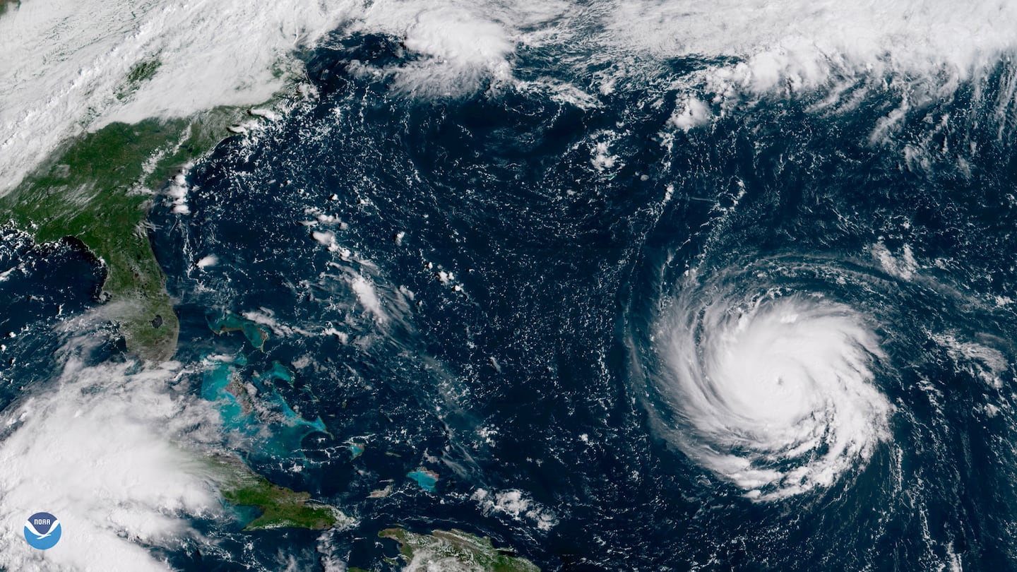
The East Coast is no stranger to hurricanes and the destruction that follows. The Saffir-Simpson scale was developed to help determine damage and flooding before it strikes.
What is a hurricane?
A hurricane is a rotating low-pressure weather system that converts the energy of warm air into winds and waves.
Hurricanes have "warm core" centers, meaning the center of the storm is warmer than the surrounding air. Warm ocean temperatures and wind patterns that spiral air inward are necessary for a hurricane to form.
>>How to use the internet during the storm when your internet is down
The “eye” of the storm is produced as the warm air rises in the storm’s center and a center of low pressure is created. When the pressure in that area drops, more air is pulled in, creating a sort of heat-pump effect that causes the storm to repeat the process and grow in intensity. The storm will continue to do so until it’s supply of warm water is interrupted.
Thunderstorms spiral out from the eye and the water is pushed ahead of the storm, building what is called a "storm surge." The storm surge forms to the east of the eye.
>>What is a storm surge and why is it dangerous?
When a system has sustained winds of 39 mph, it is classified as a tropical depression. When the winds reach 39 mph or higher, the depression becomes a tropical storm and is given a name.
At 74 mph, the system is a hurricane.
What is the Saffir-Simpson scale and what does it have to do with hurricanes?
The tropical system is assigned a category depending on its wind speed. Here are the categories, the wind speeds and what those winds will likely do once the system makes landfall:
>>What is the Saffir-Simpson scale; how does it work; is there a Category 6?
Category 1 -- 74 to 95 mph: Very dangerous winds will produce some damage. Well-constructed frame homes could have damage to the roof, shingles, vinyl siding and gutters. Large branches of trees will snap and shallowly rooted trees may be toppled. Extensive damage to power lines and poles likely will result in power outages that could last a few to several days.
Category 2 -- 96 to 110 mph: Extremely dangerous winds will cause extensive damage: Well-constructed frame homes could sustain major roof and siding damage. Many shallowly-rooted trees will be snapped or uprooted and block numerous roads. Near-total power loss is expected with outages that could last from several days to weeks.
Category 3 -- 111-129 mph: Devastating damage will occur: Well-built framed homes may incur major damage or removal of roof decking and gable ends. Many trees will be snapped or uprooted, blocking numerous roads. Electricity and water will be unavailable for several days to weeks after the storm passes. Category 3 storms and above are considered major hurricanes.
Category 4 -- 130-156 mph: Catastrophic damage will occur. Well-built framed homes can sustain severe damage with loss of most of the roof structure and/or some exterior walls. Most trees will be snapped or uprooted and power poles downed. Fallen trees and power poles will isolate residential areas. Power outages will last weeks to possibly months. Most of the area will be uninhabitable for weeks or months.
Category 5 -- 157 mph or higher: Catastrophic damage will occur. A high percentage of framed homes will be destroyed, with total roof failure and walls collapsing. Fallen trees and power poles will isolate residential areas. Power outages will last for weeks to possibly months. Most of the area will be uninhabitable for weeks or months.
Here is a video that shows the increasing level of damage in each category.
Cox Media Group


