CHARLOTTE — On Nov. 12, 2020, a late season tropical storm dumped about four inches of rain across Charlotte, inundating neighborhoods as it rushed into our local streams. The Mallard Creek rose 7 feet in University City and its waters flowed over the N. Tryon St. Bridge.
A new art installation along the Mallard Creek Greenway now marks that record flood, and also shows how much worse that high water could get.
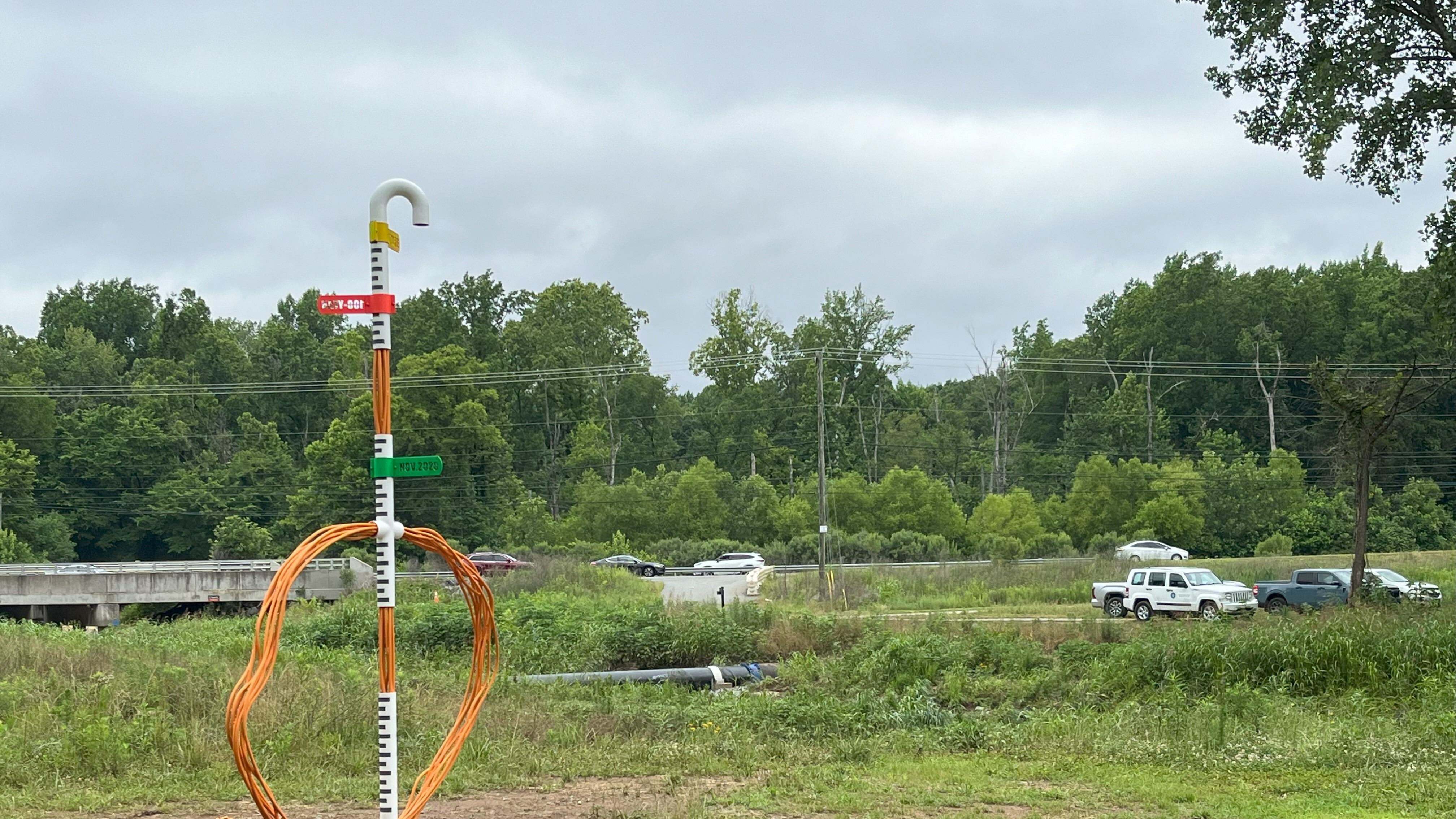
Marek Ranis, a Charlotte artist, created the piece called “Diver” in collaboration with the Arts & Science Council and Charlotte-Mecklenburg Storm Water Services. The installation is designed to look like a human head while snorkeling and it marks three potential flood stages.
The lowest stage, marked in green, is the November 2020 flood, 7 feet up from the creek. About 2 feet above that is a red marker signifying the 100-year flood mark. That’s the FEMA designated zone in which there’s a 1% chance of flooding every year. There are enforced minimum building heights in this zone and homes with federally backed mortgages must have flood insurance.
The last marker on the installation is another foot above the red line, labeled “Future” in yellow. John Wendel, the spokesman for Charlotte-Mecklenburg Storm Water Services, said that’s the current height any new buildings in Mecklenburg County must be constructed above to reduce their risk for flood damage in future storms.
“That kind of puts it into perspective when you see it,” he said. “Me telling you that or you seeing a picture is one thing, but actually you seeing it yourself hopefully you’ll get a different perspective.”
The installation also includes a sign explaining its flood markers and a QR code that allows users to scan and see an AR-generated flood simulation at each of the marked levels.
The marker and the greenway itself are both in Charlotte’s flood plain, which naturally goes through flooding during big rain events. Wendell said that keeps the water moving through the city and accumulating in streets and neighborhoods. He said it’s important this land remains dedicated greenspace because building somewhere that faces that level of consistent flooding is dangerous, expensive and impractical.
(WATCH BELOW: Plan addresses flooding and pollution along South Fork River)

©2024 Cox Media Group